 日本語 (Japan)
1. Changing of writing style and notation of Japanese when 朝鮮鉱床論 was written
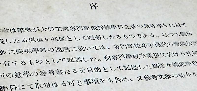
In Sadajiro Tsuchida's book 朝鮮鉱床論 (Chōsen Kōshōron, Ore deposits of Chosen (Korea)) published in Showa 19 (1944) , and many of its references, the writing style is not as formal as it was in the Meiji era, and is not extremely different from modern writing (although there are a few more kanji and some old fonts remain). However, when examining maps and documents from the Taisho era to early Showa era in order to decipher them, it is necessary to have some understanding of the changes in Japanese writing style and notation at the time.
2. Kana orthography, fonts, left/right direction of horizontal writing of Japanese language
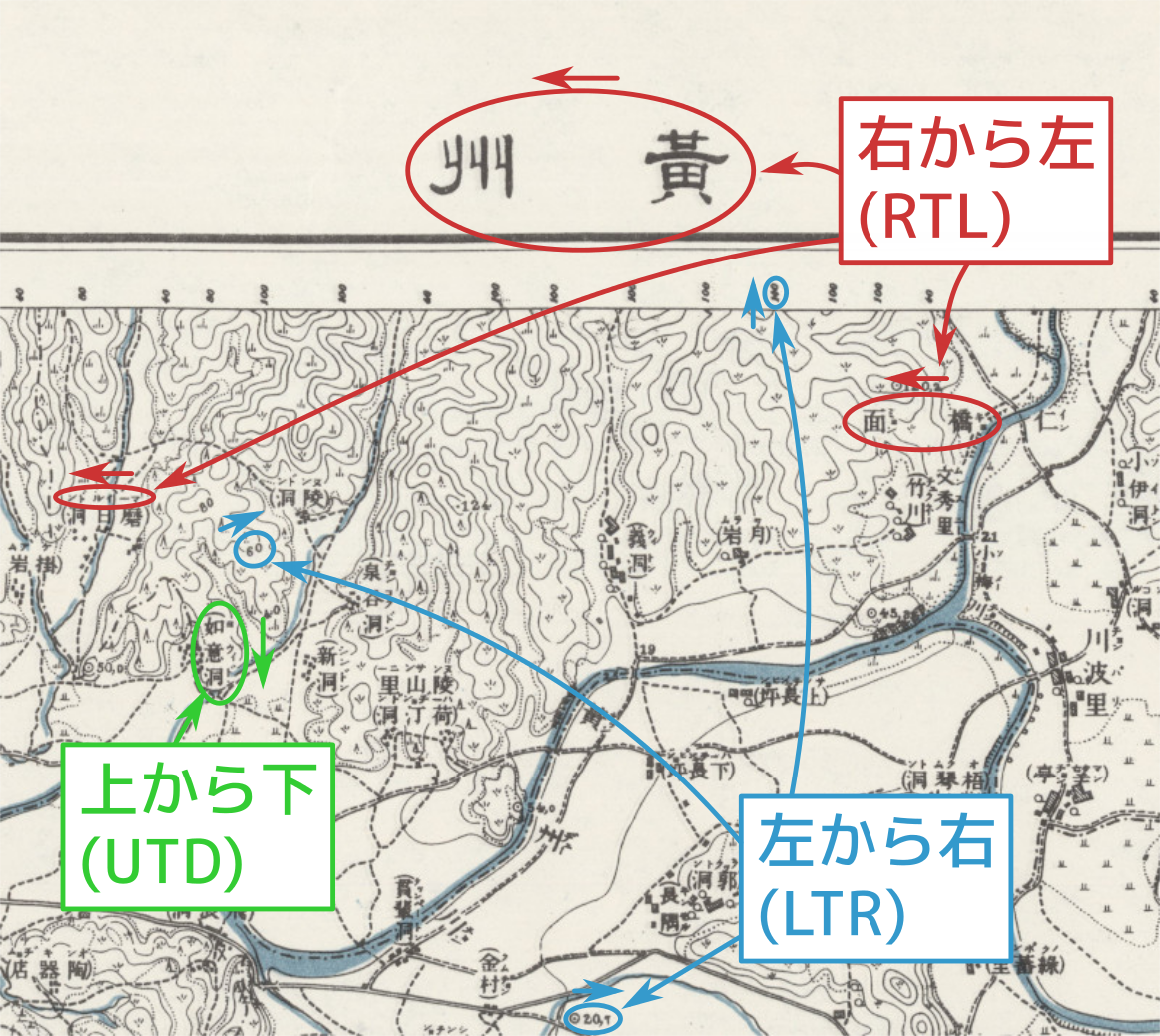
For example, in the Taisho 7 (1918) 1/50,000 topographic map, 海州 1 黄州 (こうしゅう, Kōshū, 황주), the title of the map is written from right to left like "州黄".
沙里院 (さりいん, Sari'in, 사리원) station, which can be seen near the bottom left corner of the same map sheet, has the word しやりゐん written on it. The large や was used instead of the modern small ゃ, and ゐ, which is not used in modern writing, was used. 京城 (경성) outside the frame should have けいじょう (Keijyo) as a furigana in modern Japanese, but on the map it was written as けいじやう" in an old style.
In addition, in the legends outside the frame, there are old expressions such as "荷車ヲ通セサル部" without a voiced mark and old notations, and fonts like 官廰 (官庁 (government office) in modern times) and 三角點 (三角点 (triangle point) in modern times).
Furthermore, depending on the material, There are also cases where RTL and LTR are mixed like the 朝鮮稼行鉱山分布図 (Chōsen Kakō Kōzan Bunpuzu, "Distribution Map of Korean Operating Mines") in Showa 10 (1935) . The place names on the underlying map are RTL but the mine names are LTR in it.
The spelling and pronunciation of place names also changed. In recent years, perhaps due to the fact that the use of Hangul/Choseongul has become more common than Japanese Kanji characters in Korean Peniusula, even in Japan, for example, 京畿道 is written or pronounced closer to the local pronunciation (phonetic transcription), such as キョンギド (Kyongido). In Sadajiro's time, it was pronounced as Keikidō in Japanese language (except in special circumstances). However, within the frame line of Taisho period topographic maps, most place names, except for station names, appear to be written close to the local pronunciation. For example, the katakana サリヲン (Sariwon) was given as the reading of the town 沙里院 as shown in the image unlike the name of the station しゃりゐん (Shariwin/Shari'in).
3. The necessity and concept of the translation databases for old/new Japanese and multiple languages
In this way, around the time of Sadajiro's 朝鮮鉱床論, various elements changed, even if only in the Japanese language. People of the generation who knew about those days, people who used old fonts, old kana, right-to-left, kuzushiji (cursive form), old weights and measures, etc., read old literature fluently. However, in recent years, the number of such people has decreased, and many Japanese people are likely to have difficulty reading old texts. This is even more so for people whose native language is not Japanese, and these changes are bound to create a barrier to reading comprehension.
In order to alleviate this inconvenience to some extent, it may be useful to have a bilingual table of place names, characters, pronunciations, etc. of old and new Japanese + Hangul/Chosongul + English. Nowadays, there are examples of gazetteers being provided in print or online, but most of them require a fee, probably because they are subject to frequent annual changes. Compared to such modern place names, place names that appear in materials that have stopped being revised, such as the ``50,000:1 Topographic Map of Korea'' from the Taisho period, seem easier to compile into a database. However, the number of map sections is about 722, and the number of towns, caves, and villages is 28,609 as of Showa 18 (1943) October 1, so even if it is not used as an authority for how to read place names, even if the materials (administrative division handbook, atlas index, etc.) are available, creating a database will likely require considerable effort. In the first place, it seems difficult to determine even the Japanese pronunciation (kana) of all 722 titles of the map sections. For example, the reading of the northernmost map, 鍾城 No. 2, "柔遠鎮" varies depending on the source, such as "Jūonchin" or "Yuonchin" and I, TK, have not been able to identify it.
The following is the concept of the database output (It doesn't exist). We are using 沙里院 as an example. In this way, even if there is only one place name, multiple names such as old and new Japanese, some other languages, etc. are related per each time and basis, so when designing a database, it is important to consider where to set the boundaries (coverage range) of the database system, and what kind of plan to expand it is likely to become an issue.
Output example of the translation database for old/new Japanese and multiple languages(It's just a concept and doesn't exist.)
| 項目 항목 Item | 値 값 Value |
|---|---|
| 日本の漢字表記(新字体) 일본의 한자 표기(신자체) Japanese Kanji (simplified modern form) |
沙里院 |
| 種類/유형/type *1 | PL |
| 当時の行政区画 당시 행정구획 Administrative district at that time |
黄海道 鳳山郡 沙院面 (1914-1921) 黄海道 鳳山郡 沙里院面 (1921-1931) 黄海道 鳳山郡 沙里院邑 (1931-1945) |
| 1/50,000 地形図 1/50,000 지형도 1/50,000 Topographic map |
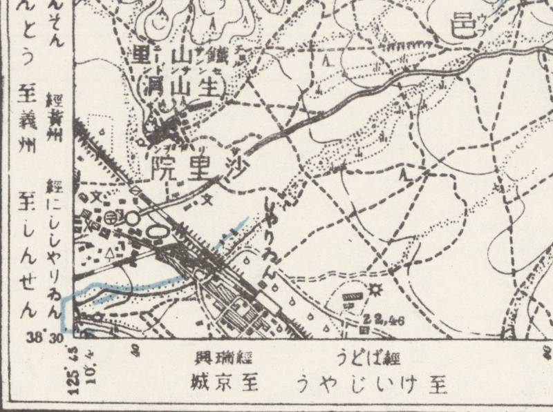
海州 1 号「黄州」(from N38°30' E125°45', Stanford=BEE-1), 海州 5 号「沙里院」(from N38°30' E125°30', Stanford=BEE-5) |
| RR式ローマ字 국어의 로마자 표기법 Revised Romanization of Korean (2000) |
Sariwon |
| MR式ローマ字 매큔-라이샤워 표기법 McCune–Reischauer romanization |
Sariwŏn |
| ハングル/チョソングル 한글/조선글 Hangul/Chosŏn'gŭl |
사리원 |
| 漢字の読みの例(ひらがな, 現代) 한자 읽기를위한 일본 음절 (히라가나, 현대) 의 예 Examples of Japanese syllabary (Hiragana, modern) for the Kanji reading |
さりいん, しゃりいん |
| 漢字の読みの例(日本語ローマ字, 現代) 한자 읽기를위한 일본 음절 (로마자 표기, 현대) 의 예 Examples of Japanese syllabary (romanization, modern) for the Kanji reading *2 |
Sariin, Shariin, Syariin |
| 当時の資料でのカタカナ/ひらがなの例 당시 문서에 나오는 가타카나/히라가나 의예 Examples of Katakana/hiragana in the documents at that time *2 |
しやりゐん (TM1/50K) |
| 原語発音に近づけたカタカナ表記の例 원래 발음에 가까운 가타카나 표기법의 예 Examples of Japanese Katakana notation closer to the original pronunciation *2 |
サリヲン (TM1/50K), シャリイン (AD1939, AD1940, AD1941, AD1943), サリウォン(OT) |
| その他の英語表記 기타 영어 표기 Other English notations |
|
| 備考 비고 Notes |
*1 種類コード/유형 코드./type code:
- PS=人/사람/person
- PL=場所/장소/place
- PD=時代/시대/period
- AD=行政区画/행정구역/Administrative district
- GE=地学用語/지질학 용어/Geological terminology
- OT=その他/다른/others
*2 資料コード/문서 코드/document code:
- TM=朝鮮総督府(1910s-1920s)地形図/지형도/Sōtokufu(1910s-1920s)topographical maps
- KK=小藤・金沢(1903)羅馬字索引朝鮮地名字彙/Kotō・Kanazawa(1903)A Catalogue of the Romanized Geographical Names of Korea
- GM=小藤(1903)朝鮮全図/Kotō(1903)General Map of Korea
- GGM=朝鮮総督府(1928)朝鮮地質総図/Sōtokufu(1928)General Geological Map of Chosen (Korea)
- AD=行政区画便覧/행정 구획 편람/Administrative district handbook
- OT=その他/다른/others