 日本語 (Japan)
1. Information related to his 朝鮮鉱床論
1.1 Changes over time that impede understanding of 朝鮮鉱床論 and its references
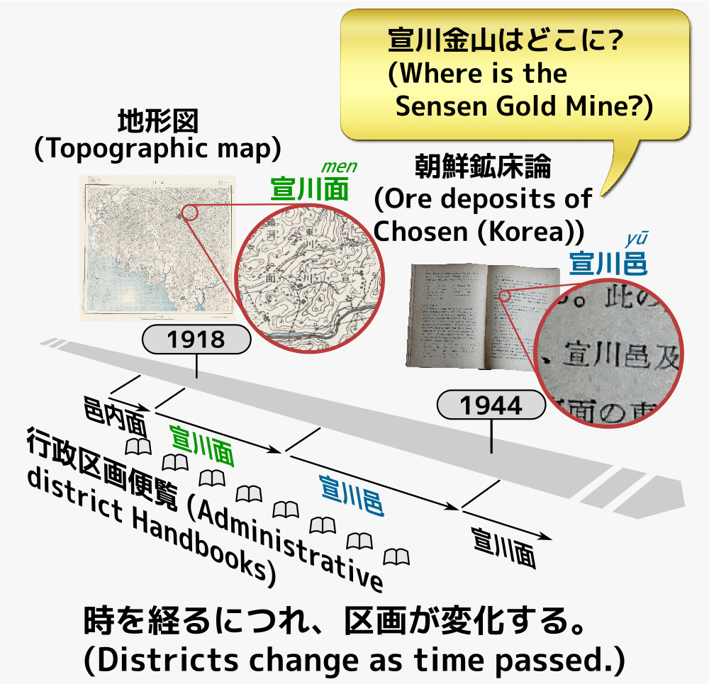
In a Sadajiro's book 朝鮮鉱床論 (Chōsen Kōshōron, Ore deposits of Chosen (Korea)) (hereinafter referred to as his original) published in Showa 19 (1944) , dozens of gold, silver, iron, etc. mines are introduced, and readers may want to know the location of each mine from the described place names like 道/郡/面 (Dō/Gun/Men). However, identifying the location from the written place names is not an easy task. One of the reasons, as the author himself mentions at the beginning, there are no illustrations in the book. Also, although the references are listed for each chapter, the correspondence between the main text and the literature is unclear, and as shown in the table belowmany matters/things change over time , so the place names and administrative divisions written in his original and/or its references may not match with the ones descrived in maps. For example, even though his original says "宣川郡 宣川邑" (Sensen-gun Sensen-yū, Seoncheon-eup in Seoncheon-gun), it had not yet been promoted to an 邑 (Yū, eup) in 1916-1918, when a series of the topographic maps first edition was created, so we need to search for 宣川面 (Sensen-men, Seoncheon-myeon) in the maps.
Things that change over time include:
| # | Things that change over time | Examples | Supporting documentation for basis |
|---|---|---|---|
| 1 | Geography | Mines, Stratigraphy, Railway lines, Station names, Roads, Administrative districts, Place names | Mining claims (鉱区一覧), Journals, Railway Bureau annual reports (鉄道局年報), Topographic maps (地形図), Administrative district handbooks (行政区画便覧), Lighthouse lists (灯台表) |
| 2 | Academic knowledge | Reports from academic societies and research institutions | Academic journals, Magazines, Reports |
| 3 | Substance | Mineral name, Chemical composition, Crystal structure, Periodic table of elements (周期表) | Pictorial books (図鑑), Mineral dictionary, Textbooks, Chronological scientific Tables (Handbook of Scientific Tables, 理科年表) |
| 4 | Japanese language | RTL/LTR horizontal writing, Old-style Kanji, Historical Kana orthography, Okurigana | Japanese Language Council reports (国語審議会答申), Cabinet notifications and directives (内閣告示) |
| 5 | Laws | Law amendments, Government-general ordinances | Official gazettes (官報) |
| 6 | Technology | Exploration, Mining, Testing, Smelting, Dredging, Logistics | Test reports (試験報告) |
| 7 | Economy | Supply and demand, Commodities, Currencies, Investments |
In order to decipher his original and references and check their authenticity, it is necessary to track these information that changes over time in a cross-sectoral manner , taking into account the time axis.
1.2 Terrain changes
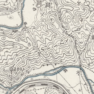
The terrain itself also changes. Comparing with modern aerial photographs, we can see that flow path of a river that were meandering in the Taisho era topographic maps are now shortcuts due to erosion (or artificially?). There are some other areas that were submerged in huge dam lakes. Furthermore, even topographical maps from the Taisho period can be seen dotted with holes that appear to have been the remains of open-pit gold dust mining, and place names that suggest that the area was once bustling with mining activity.
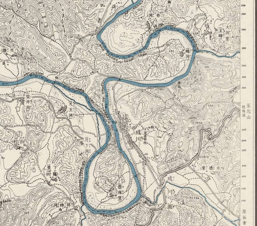
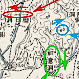
This map is a part of Topographic Map Kokusan (谷山, こくさん) No. 13 "Seisen" (成川, せいせん) surveyed in Taisho 7 (1918) modified in Showa 11 (1936) , around latitude 39.25°N and longitude 126.21°E. This shows that the west-flowing Futsuryūkō (沸流江, 비류강, Piryu-gang) is still meandering considerably. West of the city Seisen (成川, 성천, Sŏngch'ŏn), a symbol of a boat and a sidewalk are drawn near the point where the flow path make its closest approach each other, and the road continues to the west, so we can imagine that this is a small ferry (the first edition of the topographic map shows that another boat symbol is drawn on the west side of the point). In modern times the river is shortcut from the point to the west.
In addition, a mining site symbol is shown on the south bank across the northeastern hill from the city of 成川. We can see it as the 三川 (みかわ?/さんせん?, Mikawa?/Sansen?) mine, which was introduced in his original.
1.3 Related information of each field
In recent years, fortunately, thanks to the efforts of many people and institutions in various countries, various databases have been developed. We can now easily view a lot of information from the Taisho era to the early Showa era that were used in Sadajiro's time such as Topographic maps, Administrative division handbooks, Mining claims (List of mines), Railway Bureau annual reports, Papers, Magazines, Pictorial books, etc. Even if books and other documents are not available online (due to copyright issues), we may be able to view them for free or request copies for a fee from terminals in major libraries in Japan.
Regarding public information, etc., each page below shows link to editions from multiple publication years. (In case of topographic maps, There are at least first editions from around Taisho 5 (1916) to Taisho 7 (1918) and revised editions after around Showa 10 (1935) .)
Re-edited Chōsen Kōshōron, (Ore deposits of Chosen (Korea))
 Read more
Related maps
 Read more
Changing of style and notation for Japanese language
 Read more
Administrative districts
 Read more
Mining claims (List of mines)
 Read more
Railway Bureau annual reports
 Read more
Official gazettes
 Read more
Searching for articles and journals
 Read more
Pictorial books and properties of matter
 Read more
Materials by research institutions
 Read more
Stratigraphic charts
 Read more
Place name dictionaries
 Read more
About the source of images
Of the images above, the administrative districtions, mining area list, Railway Bureau annual reports, Pictorial books, and Place name dictionaries were created by processing them based on the following from the National Diet Library Digital Collections.
- 朝鮮総督府官房地方課 編『朝鮮行政区画便覧』昭和18年10月1日現在,朝鮮行政学会,1944. https://dl.ndl.go.jp/pid/1454489 (参照 2023-04-25)
- 朝鮮総督府殖産局鉱政課 編『朝鮮鉱区一覧 : 昭和16年7月1日現在』,朝鮮鉱業会,1942.2. https://dl.ndl.go.jp/pid/1905834 (参照 2023-04-25)
- 朝鮮総督府鉄道局 [編]『年報』昭和10年度第1編,朝鮮総督府鉄道局,昭和11. https://dl.ndl.go.jp/pid/1079352 (参照 2023-05-23)
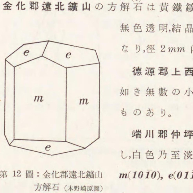
- 朝鮮総督府地質調査所 編『朝鮮鉱物誌』,三省堂,日本出版配給,1941. https://dl.ndl.go.jp/pid/1903765 (参照 2023-04-25)
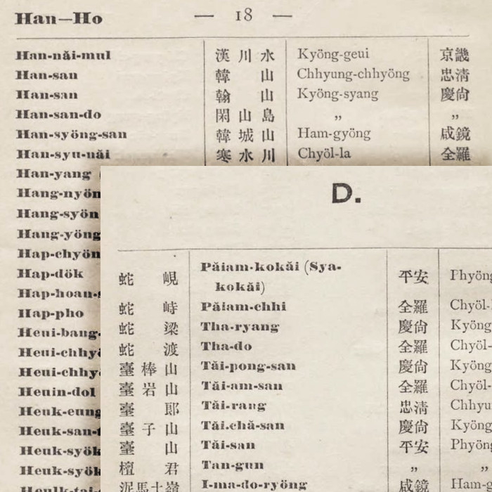
- by B. Kotô and S. Kanazawa『A catalogue of the romanized geographical terms of Korea』,Tōkyō Teikoku Daigaku,Maruyap,1903. https://dl.ndl.go.jp/pid/1678549 (参照 2021-06-12)
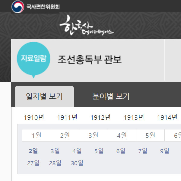
Of the images above, we used a screenshot from the web page of the National Institute of Korean History, NIKH (국사편찬위원회) - Official Gazette of the Governor-General's Office (朝鮮総督府 官報).
Of the images above, the topographic map used is from the Stanford Geospatial Center (USA), which is in the public domain.
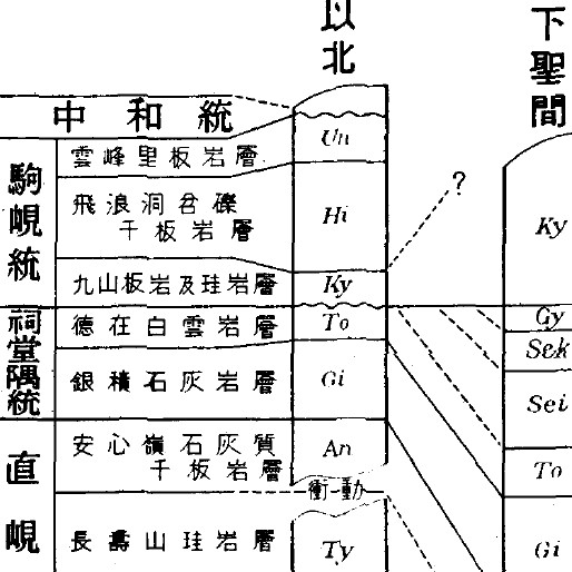
Of the images above, the stratigraphy images used is from materials published by the Kyoto University Research Information Repository.